![[HEADER]](/images/framing/academy-header.gif "[HEADER]")
|
There are several ways to plot a course in 3-dimensional space. One way is to provide a flight vector specified as an azimuth/elevation relative to another flight vector (usually the vessel's current orientation). This method, using the spherical coordinate system, gives the azimuth and elevation values as angles relative to another vector. These angles, the "bearing" and "mark", respectively, are given in degrees, with 360 degrees being equal to one full rotation. |
BEARING 301, MARK 000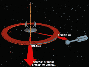 |
BEARING 019, MARK 038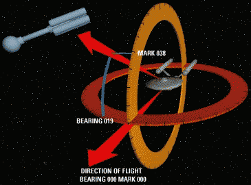 |
MARK 329, BEARING 322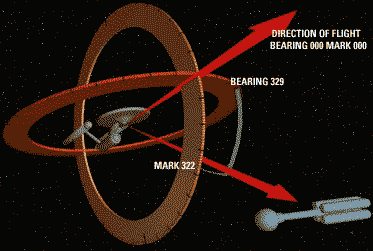 |
NOTE: After an incident involving a certain Confederation Helm Officer placing the lives of her crewmates at risk, UCIP Command has expressly forbidden the use of warp speeds while trying to navigate through an asteroid belt :)